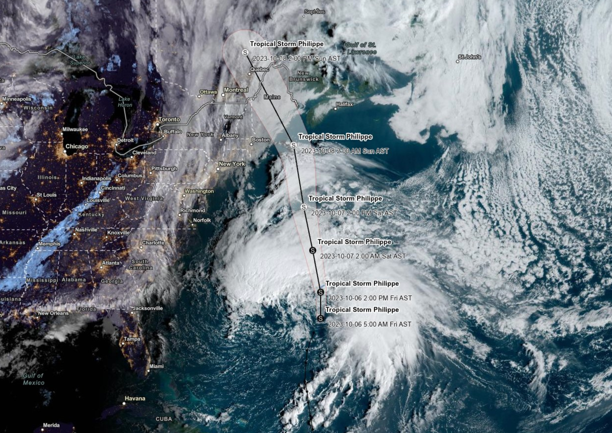
Philippe weakens to post-tropical cyclone on path towards New England
Philippe is expected to reach the coast of Nova Scotia, New Brunswick or eastern Maine on Saturday night into Sunday

Sign up to the Independent Climate email for the latest advice on saving the planet
Get our free Climate email
Tropical Storm Philippe picked up speed on Friday and deluged parts of the Caribbean on a path toward New England and Atlantic Canada.
A tropical storm warning was in effect for Bermuda amid 50mph winds and heavy downpours from Philippe’s outer bands. One to three inches of rain is expected across Bermuda on Friday, leading to possible flash flooding.
By Friday afternoon, Philippe weakened to a post-tropical cyclone but still posed a risk of flash flooding in parts of the Northeast this weekend, according to the National Hurricane Center (NHC).
A turn toward the north-northwest is forecast by early Sunday and Philippe is expected to reach the coast of Nova Scotia, New Brunswick or eastern Maine on Saturday night into Sunday, NHC reported.
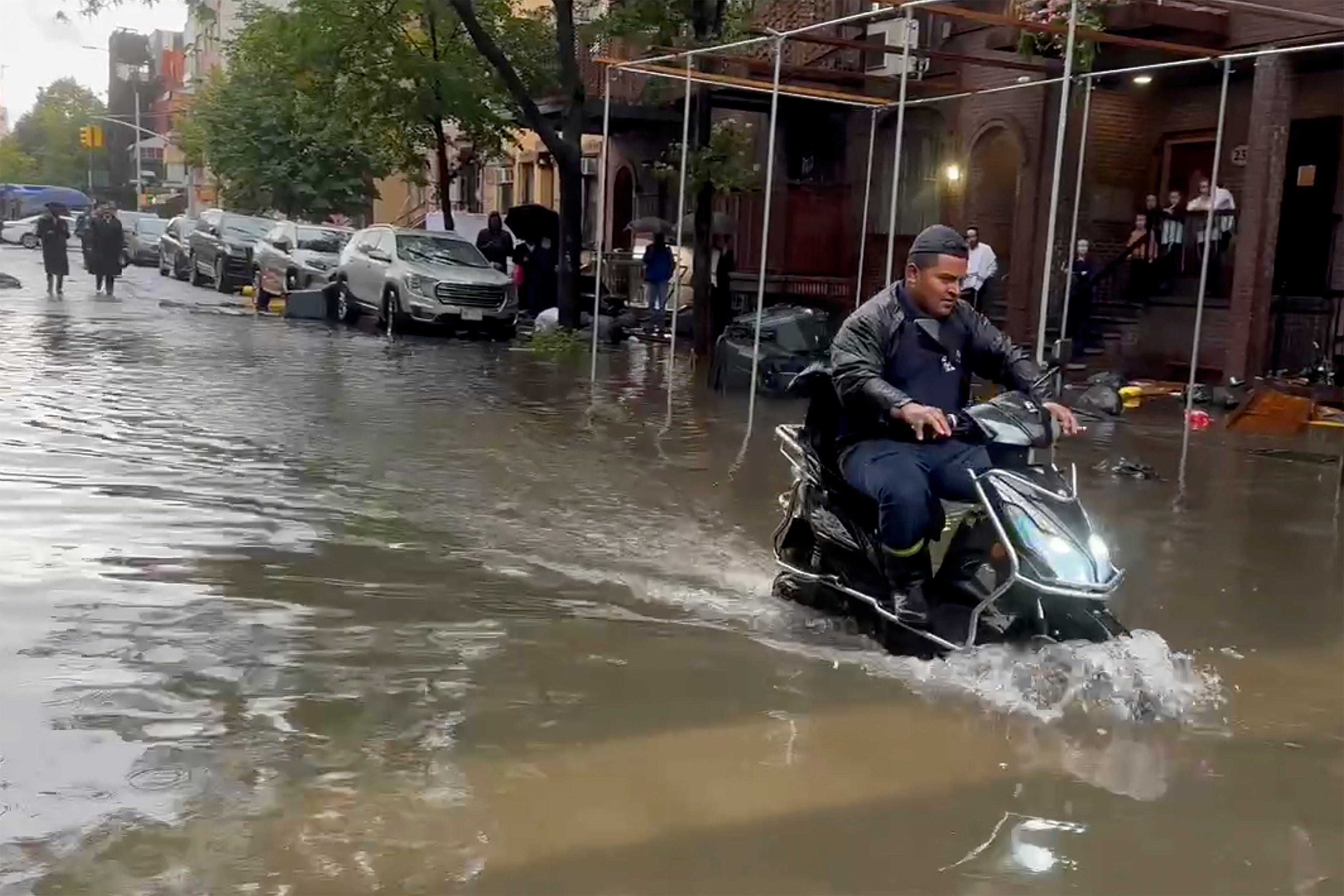
Parts of New York and New England could see one to three inches of rain this weekend with up to five inches expected in some areas. Isolated to scattered instances of urban and flash flooding are expected, forecasters said.


A flood watch was issued for New York City from Friday until Saturday evening with heavy rain possibly resulting in flooding particularly in low-lying areas or places with poor drainage.
Southeast Canada will also see one to three inches in areas with local amounts of five inches.
Large swells from Philippe, and another weather system, will continue to impact Bermuda’s coastline in the coming days.
Those swells will reach the US southeast and spread north along the east coast to Atlantic Canada in the coming days, causing “life-threatening surf and rip currents”.
Earlier this week, communities in Guadeloupe lost power and running water while schools were closed in Antigua and Barbuda, St Martin and St Barts due to the storm.
On a hotter planet, more water vapor is held in the atmosphere, meaning a greater chance of intense rainfall from storms.
In the US Northeast, the volume of rain in very heavy events increased by 55 per cent from 1958 to 2016, according to meteorologist Terran Kirksey, from the nonprofit Climate Signals. Much of that increase has taken place since 1996 due to the human-driven climate crisis.
The latest report from the UN’s top climate science panel found that the frequency of “1-in-10 year” extreme rainfall events has increased 30 per cent globally.
In addition, climate change is causing sea level rise which compounds the danger of storm surge.
Subscribe to Independent Premium to bookmark this article
Want to bookmark your favourite articles and stories to read or reference later? Start your Independent Premium subscription today.
Join our commenting forum
Join thought-provoking conversations, follow other Independent readers and see their replies
Comments