Site plots flight paths in real time
A site that tracks European aircraft movements in real time across Europe has launched, allowing web users to track the hundreds of planes in the sky at any one time.
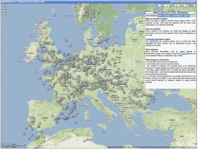
RadarVirtuel, a project from a group of aviation enthusiasts, plots information such as the speed, altitude or call sign of aircraft on Google Maps. Although the site has provided information on French airspace for some time, it now includes movements across many European countries.
Logging onto the site shows the position of aircraft, delayed by approximately four minutes, with their current heading and route.
"We believe that this information can be useful for various needs (locating an airplane for personal or business purposes, computing statistics)," say the owners of the site. "Notably it can lead to a better public understanding of what happens above our heads."
The RadarVirtuel project uses a network radar equipment owned by third parties to plot the (publicly accessible) information on Google Maps. Users can filter based on aircraft type, callsign, airport code or airline.
Website: http://www.radarvirtuel.com
Join our commenting forum
Join thought-provoking conversations, follow other Independent readers and see their replies
Comments