Tropical system to bring heavy rain, flooding to Gulf Coast
Bands of rain and brisk wind are hitting parts of the U.S. Gulf Coast as a disorganized tropical weather system moves north

For free real time breaking news alerts sent straight to your inbox sign up to our breaking news emails
Sign up to our free breaking news emails
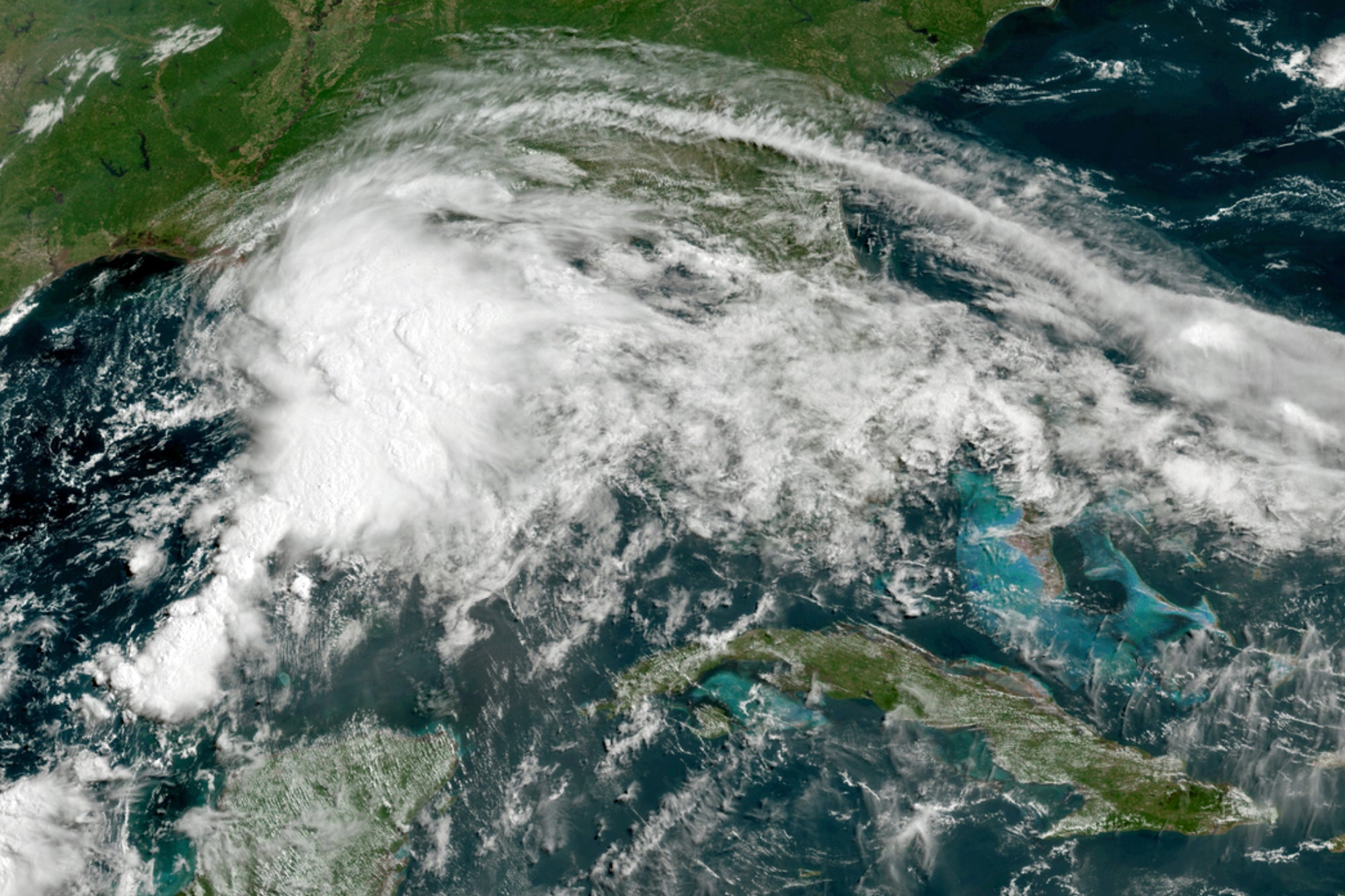
Officials ordered a floodgate and locks system closed in southeast Louisiana and readied sandbags in Mississippi and Alabama as a broad, disorganized tropical weather system began spinning bands of rain and brisk wind across the northern Gulf of Mexico coast Friday.
The system had not yet reached tropical storm strength as of mid-morning. But, in anticipation of strengthening, a tropical storm warning was in effect for parts of Louisiana, Mississippi, Alabama and Florida — extending from Morgan City, Louisiana, to the Okaloosa-Walton County line in the Florida Panhandle. Flash flood watches extended along the coast from southeast Louisiana into the Florida panhandle and well inland into Mississippi, Alabama and western Georgia.
Children could still be seen playing on the beach under cloudy skies, with a rougher-than-usual surf roaring, at Gulf Shores, Alabama. Business owners kept an eye on the weather, hoping it wouldn't ruin a Father's Day weekend for the tourism-dependent coast.
At Tacky Jack’s, a popular restaurant on the Alabama coast in Orange Beach, “the winds are blowing pretty fast today so hopefully that wind will make the storm move faster and blow on out of here,” kitchen manager Greg Paddie said Friday.
“I hope it just gets in and gets out,” said Greg Paddie, manager of Tacky Jack's, a restaurant at Alabama's Orange Beach.
“Anytime there’s a tropical storm in the Gulf, we pay attention to it,” said Ryan Schumann in Mobile, Alabama.
Schumann, who is president of the Alabama Deep Fishing Rodeo on nearby Dauphin Island — one of the world’s largest fishing tournaments — is thankful the event is scheduled for next month, not this weekend.
By midmorning Friday, the system was centered about 220 miles (355 kilometers) south of Morgan City, Louisiana, with maximum sustained winds of 35 mph (55 kph). It was moving north-northeast at 14 mph (22 kph).
In Louisiana's vulnerable Plaquemines Parish, the local government warned mariners that locks and a floodgate in the Empire community, near where the Mississippi River meets the Gulf, would close at noon.
Louisiana Gov. John Bel Edwards issued a state of emergency late Thursday. The move is an administrative step that authorizes the use of state resources to aid in storm response efforts.
The system is expected to produce up to 8 inches (20 centimeters) of rain across the Yucatán Peninsula of Mexico, and up to 12 inches (30 centimeters) through the weekend along the central U.S. Gulf Coast
The combination of storm surge and the tide will cause normally dry areas near the coast to be flooded by rising waters moving inland from the shoreline, the hurricane center said. The water could reach heights of about 1-3 feet (30-91 centimeters).
In Orange Beach, Paddie said Tacky Jack's still has sandbags left over from its preparations for last year's Hurricane Sally. That storm threw ships onto dry land, knocked out power to hundreds of thousands of people in Alabama and in the Florida panhandle. Two people in Alabama were killed in the September storm.
The threat of heavy downpours reached far inland. More than 140 miles (225 kilometers) from the coast, organizers of a Juneteenth festival in Selma, Alabama, cited the weather in postponing a daylong celebration until August.
Flood watches also extended into north Georgia. Up to 6 inches (15 centimeters) of rain will be possible in parts of west Georgia as the storm moves on its expected path to the northeast, the National Weather Service said.
There have already been two named storms during the 2021 Atlantic hurricane season. Meteorologists expect the season to be busy, but not as crazy as the record-breaking 2020 season.
Mexico, while getting rain from the storm in the Gulf, was also threatened by a storm in the Pacific. Tropical Storm Dolores formed Friday morning and was expected to make landfall on Mexico’s west-central coast Saturday evening, possibly near hurricane strength, according to the National Hurricane Center.
Subscribe to Independent Premium to bookmark this article
Want to bookmark your favourite articles and stories to read or reference later? Start your Independent Premium subscription today.