UK weather: Month of rain expected in one night as Met Office and Environment Agency issue severe flood warnings
Rain will be falling on already saturated ground, threatening more than 1,000 homes

Get the free Morning Headlines email for news from our reporters across the world
Sign up to our free Morning Headlines email
A month’s rain is expected to fall in a single night over some parts of the UK, as major weather warnings were issued by the Met Office and Environment Agency.
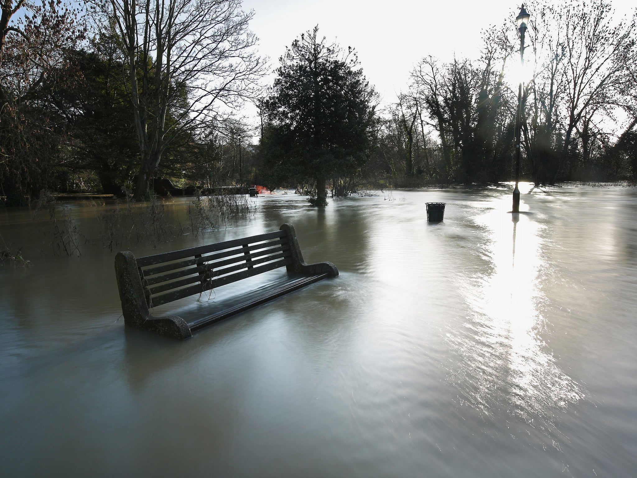
Severe warnings, meaning a threat to life from flooding, have been issued for the six worst-affected areas in South Cumbria, among 73 warnings across north-west England and south-west Scotland.
The heavy rain is caused by moist tropical air, brought about by the remains of ex-hurricane Kate, which began forming in the Bahamas but has weakened as it heads towards the UK. Northwest England and southwest Scotland will bear the brunt of the rain, before clearing as it heads southeast.
The Met Office issued amber weather warnings which apply to areas across northern Wales, northern England and Scotland, meaning the public should be prepared to take action.
Cumbria Police warned motorists to drive "only if absolutely necessary" due to torrential rain leaving roads flooded. Chief inspector Matt Kennerley said: "Many of the county's roads, including the A66 at Threlkeld, have minor road surface flooding. Our advice is to drive only if necessary today as it is expected, that with further deteriorating weather conditions, more roads will be affected with an increasing severity.
"If you must drive, please do so with extreme care. Motorists should not drive through any floodwater of which they cannot judge the depth."
On opposite sides of the Lake District, the towns of Egremont and Kendal are on high alert due to rising river levels. Councils estimate up to 1,000 properties in Kendal and 600 in Egremont will be under threat. Emergency reception centres have been set up in both towns.
Environment Agency Director of Incident Management Craig Woolhouse said: “Heavy rain is falling on already saturated ground causing rivers to rise and bringing a risk of flooding across the northwest. We urge people to check the risk of flooding in their area, sign up for flood warnings and be prepared to take immediate action.”
The Environment Agency said it has teams deployed across the country to provide additional support in worst-hit areas. They will be out "maintaining flood defences, preparing temporary barriers, deploying sandbags along riverbanks, clearing out river blockages" as well as keeping an eye on water levels.
Tonight’s wet weather follows downpours that hit the Midlands and the Home Counties on Thursday and Friday. Many parts of the warning areas could see as much as 50-80mm of rain, with some parts of north Wales and northwest England possibly receiving as much as 200-250mm.
Met Office forecaster Jenna McGregor told The Independent: “There’ll be rain throughout the day making its way eastwards, with amber warnings issued in the south of Scotland and north of England. There is potential for the rainfall overnight to accumulate up to 200-250mm on high ground, so the public should be aware and prepared for any flooding. Rising river levels and travel disruptions could also affect the public.”
The rest of the month is expected to be damp and windy, according the WeatherCast. The Met Office also predicts more rain moving southwest from Monday onwards, with rain in most areas on Tuesday.
Additional reporting by PA
Subscribe to Independent Premium to bookmark this article
Want to bookmark your favourite articles and stories to read or reference later? Start your Independent Premium subscription today.
Join our commenting forum
Join thought-provoking conversations, follow other Independent readers and see their replies
Comments